I have always kind of heard about the Hennepin Canal. But, hey, not much about Illinois is cool or interesting right? Since getting back on the bike, I’ve been
looking for things around here to explore and the canal came across again and
again on my google earth searches for abandoned bridges. It didn’t take long to realize there was
something unique about this.
More research revealed this was another example of screwed
up Illinois
politics and a great example of the state at its finest in the same breath.
From Wikipedia:
“The Hennepin
canal was first conceived in 1834 as a connection between the Illinois
and Mississippi River, but financial problems
in the state delayed many public
works projects. Construction began in 1892 and the first boat went through in
1907, reducing the distance from Chicago to Rock Island by 419 miles
(674 km). While the canal was under construction, however, the Corps of
Engineers undertook a widening of the locks on both the Illinois
and Mississippi Rivers. The new locks on those rivers
were twenty and forty feet wider than the canal locks, making them obsolete
before their initial use.”
So, the BS politics created
decades of hesitation. By the time it
was built, Illinois
was once again too far behind and the canal was obsolete by its opening. I have heard and read that the canal was
finally built to serve as a laboratory study for the Panama
canal. Parts of that conspiracy
theory do make sense, and I heard old timers saying the same thing on this
trip, so it must also be a part of local folklore. I tend to believe it. Why else would there be so many variances in the locks? There are span, lift, and slide bridges. This thing is a lab of various engineering strategies that were cutting edge at the time.
More Wikipedia:
“The Hennepin was
the first American canal built of concrete without stone cut facings. Although
the Hennepin enjoyed only limited success as a waterway, engineering
innovations used in its construction were a bonus to the construction industry.
The canal was used as a training ground for engineers that later worked on the Panama Canal.[2]
Both the Hennepin and Panama Canals used concrete lock chambers and both used a
feeder canal from a man made lake to water the canals because both needed water
to flow ‘uphill.’”
I had to check it
out. With “closed on Fridays” summer
hours, I took off Thursday around 4 and headed down to my buddy’s house in Peru, IL. Spend the night. From there, a short ride would get me to
Bureau Junction which holds locks 2 and 3 and the beginning of the canal.
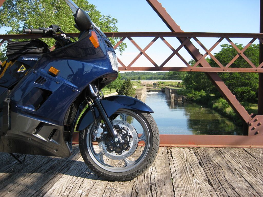
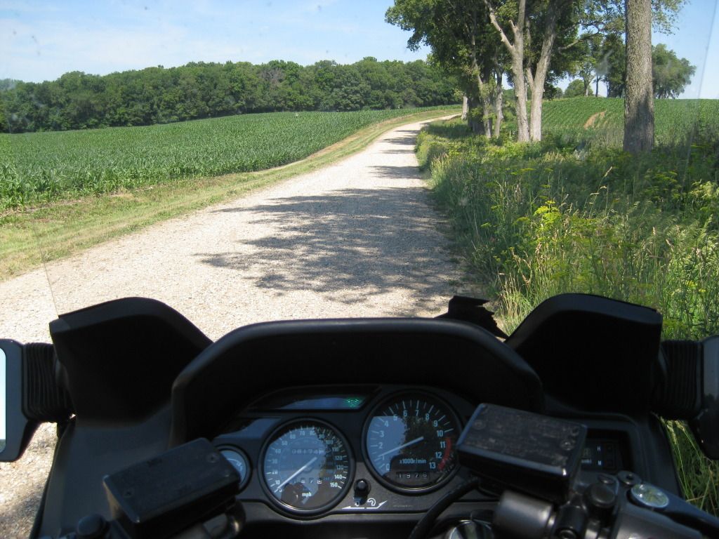
The ride to
"D's" was an easy and smooth 80 miles or so.
Couldn’t help but grab this pic.
These things always draw me in!

Stopped off at the Indian Creek Massacre site. A very cool park is there now and some pretty interesting history. An old man was there riding a quad and picking up debris. The cool things was his dog would wait until that quad came to a complete stop before jumping off and digging, barking, or getting petted by me. Didn’t get his name!
Here is a day ride I did there with my wife explaining a little more about the history.
http://leroylanes.blogspot.com/2012/04/indian-creek-massacre-day-ride.html
The markers:

Got to his house
by 7. Grill, brews, and reserve
whiskey. Great night with a T bone,
stuffed mushrooms, and salad dinner.
Didn’t get a pic of the food porn, but here is "D" with the prior to being cooked T
Bones:

Couldn’t get a
real pic of him cause he thought once I posted, he’d get all kinds of bikers
stopping by his house. So, if you need a
place to crash and get fed out that way, PM me and I’ll get you his
address. He’ll love that!
Down there by the
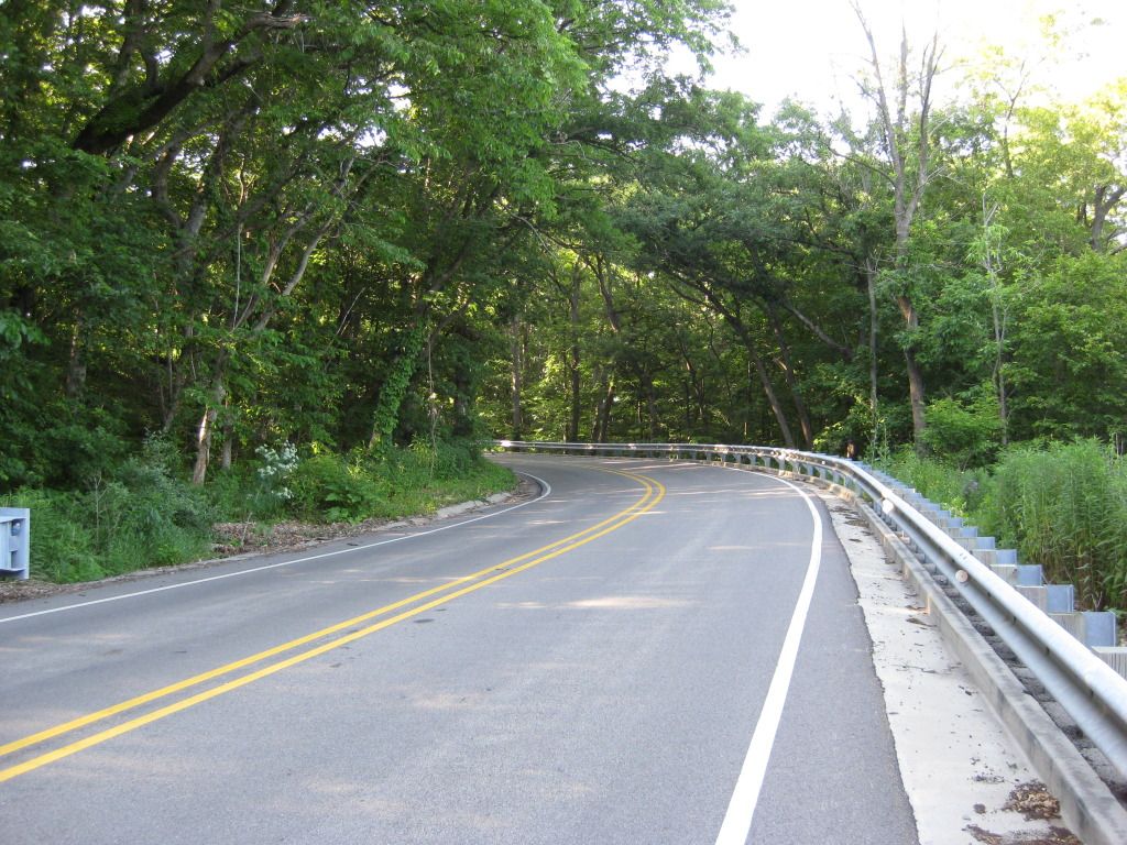
Illinois river, we get some great roads for
this area. Morning found me heading down
IL29 and just loving the road.
Bureau Junction
houses locks 2 and 3. Lock 1 is only
accessible in winter – you have to take the ice road. While it is named after Hennipen, that town
is on the other side of the Il River.
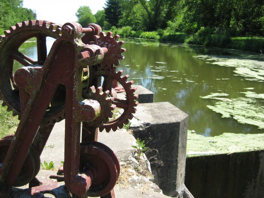
Lock 2 gearing:

A common site – even in the extremely rural areas, people were fishing. I heard about the good fishing along the canal, so expected this. What I didn’t expect was to find several pairs of women fishing throughout the day.
This was Julie
and Sue just as Julie caught a little blue gill:

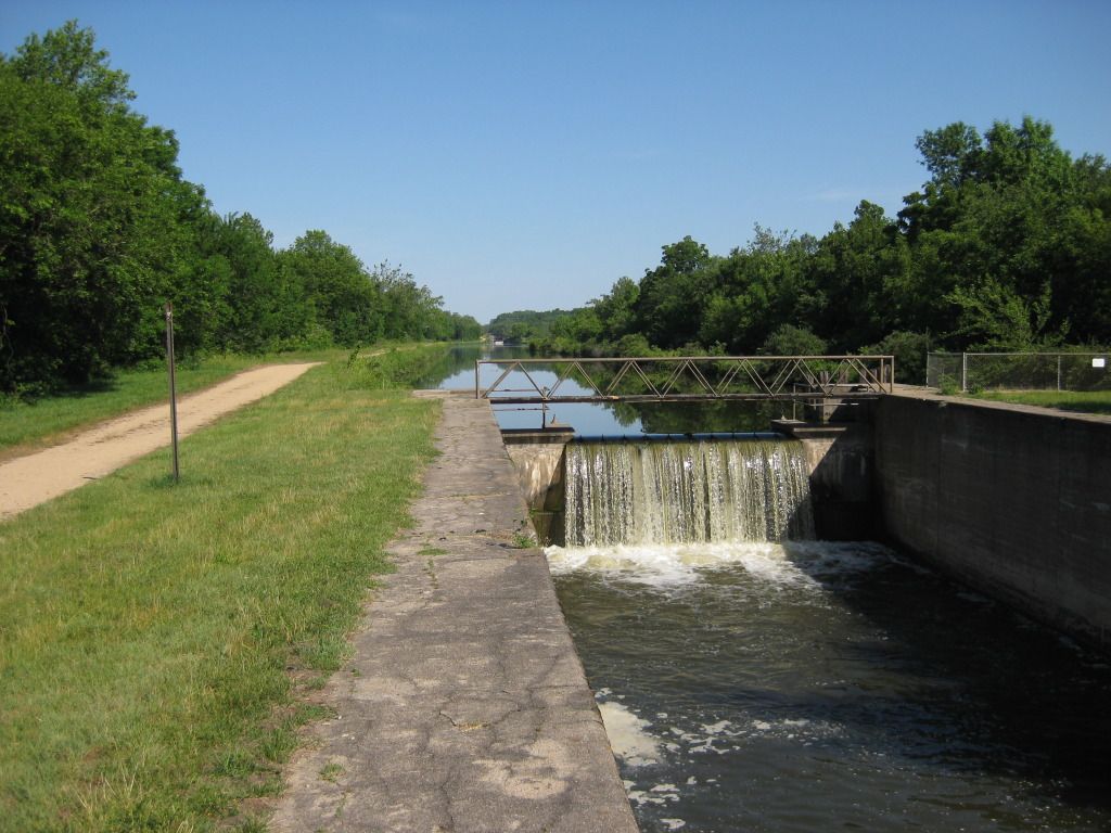
A common site was the moving water. At EVERY lock I saw, water was moving though we have not had much rain lately:

One of the
features I really wanted to see were the Aqueducts. Basically, this carries the canal over
existing creeks and rivers. The path to
Aqueduct 3 was to cross this bridge.
Maybe if my wife was here I would have shown off. Alone, I didn’t want to risk it:

Lock 11 was
awesome. The lock was the same as the
previous, but the original span bridge was still operational – barely. It was a two track, dirt gravel road to get
to it. Way too cool and the Connie did
just fine. Here is the bike on the 1900
bridge with the lock behind it:

The birthmark:

Bridge to dirt:

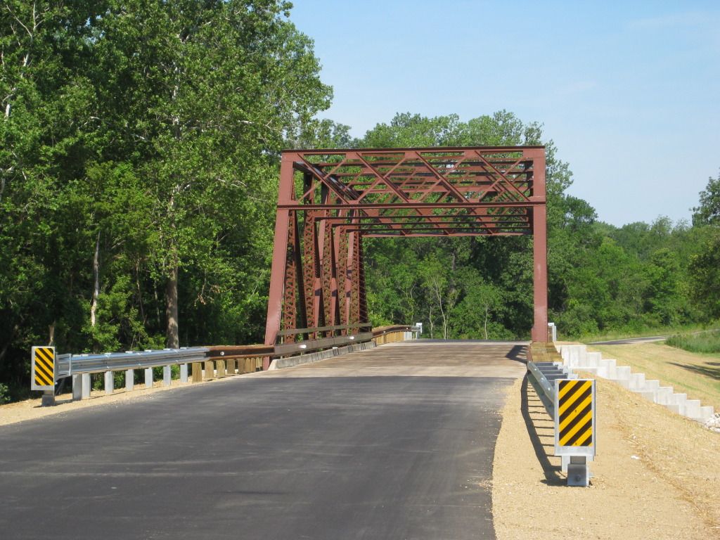
Now, most of the
span bridges are closed / don’t function.
A perfect example of that is at lock 14:


You shouldn’t
really graffiti anything that starts with 18!!!
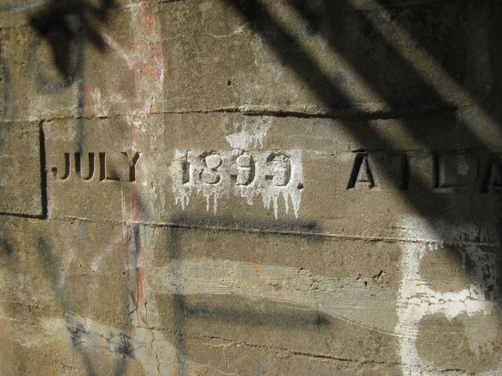
This bridge is
from that time. Instead of disregarding
or letting it degrade, the deck was poured in fresh concrete (fresh as in this
year so it must have been updated at least one other time in the past) and the
people in the area use it. A useful
remnant of times gone by:
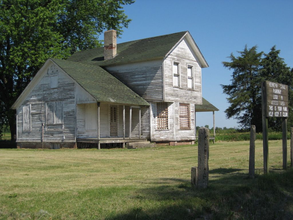
While the canal
was active, there were lock masters employed to open and close the locks, raise
or slide the bridges. They were given houses
to live in. Only a few remain. Here is one:
This was one of
the many locks with a walking bridge. It
was pretty cool to walk over the top and get a good view of the water pouring
over.

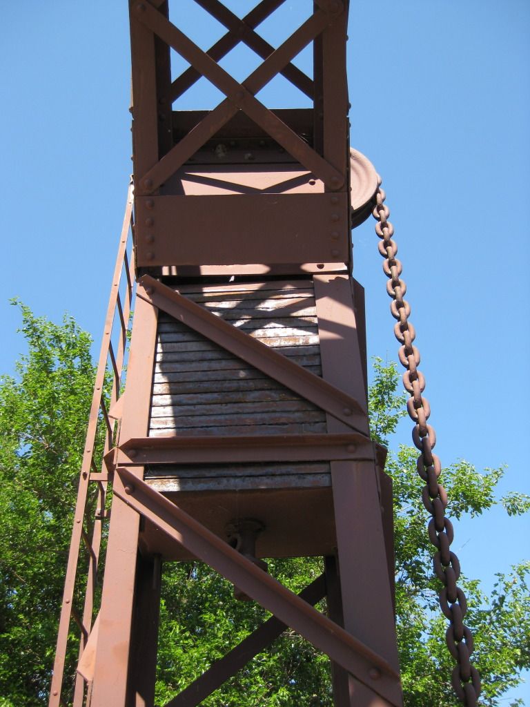
Lock 17 was
something I really wanted to check out. It
has a sliding bridge. The way it works
is that you drive up from the side, turn in to the bridge and transverse the
canal. When a boat came, the bridge slid
out on rails and allowed it to pass. Currently,
it is in the bridge mode and I crossed it on to dirt roads. In the pics, the bike is on the rear edge of
the bridge for scale.

And the rails:

The full view:

Lock 21 also had something I really wanted to understand – a lift bridge. These were added to help farmers travel to their fields. The idea is that the weights help counter the weight of the bridge. As the gearing turns, the bridge physically lifts allowing boats to pass. Too cool for a geek like me!

There are some places where new roads have been built over the canal. Mounds of earth and road were placed on top of culverts allowing the canal waters to still flow. Here is one example:

Since the canal
pretty much goes at an angle and Illinois
pretty much has perpendicular roads, there was a lot of zig zagging. The canal also created many creative roads in
VERY rural areas. Led to a lot of dirt
roads like this:
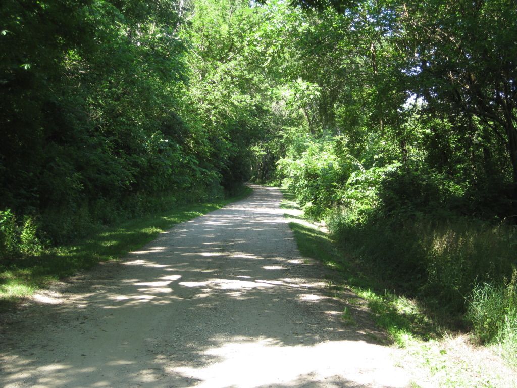
And this. Can you see the tractor coming from on high and meeting me in that turn almost taking a piece of me with him? I sure didn’t….
All told, I probably rode almost 10 miles of dirt on a street bike chasing this thing. A few fish tales made me feel right at home remembering the old CR 125 days….
Around here, the
canal meets up with a feeder canal cut from the Rock River
about 30 miles North.

The entire length
of the canal has a walking / biking / horse back path. Originally, this path was built for draft
animals to pull the boats. By the time
it opened, all the boats could propel themselves and the path was NEVER used
for that purpose. Today, it is used by
many. Though not an avid cyclist, I’d
consider a weekend riding / camping trip along the canal. However, I would NOT
want to ride a horse through one of these tunnels! I imagine they dismount.

Show you what a
geek I am, lock 22 has a functional lock AND a lift bridge. Oh the joy ….
This is the
gearing that opened and closed the locks:

Here are the
“downhill side” doors partially open:

And the “uphill side” using the spillover windows:

Around lock 24, I
spotted even more people fishing. Tammy with her niece Megan who just graduated
from college.

At the town of Colona, the canal meets the Rock River, and, in turn, the Mississippi soon after.
They have done a
great job of creating a park around the canal and a mile long road following it
to the end.
Here is the final
lock going into the Rock River. A group of 10 or so teens were just setting
off on a tube float as I showed up.

By 1951, the
canal was no longer in service.
Ultimately, it was a commercial failure – but an engineering
marvel. If constructed when planned in
the 1830’s, it would have been extremely viable. Problem is, they built it from the old plans
more than half a century later. Ahhh Illinois!
The ride home was
pretty uneventful. Learned a lot of
things on this ride. Besides the
engineering of the canal, I actually saw my dysfunctional home state get
something right. The entire canal,
including the feeder canal, is a state park. Free to use the entire way and
official camping in 9 of the lock areas.
Although a work day, I saw nearly 50 people enjoying the canal and
fishing, relaxing. All told I saw 20 of
the 33 locks. Probably could have gotten
to more with a few mile long hikes. The
best way to see the entire length is to bike, hike, or horse ride the path.
I am with the
conspiracy folks. This thing would never
have been built were it not for the need of a Panama Canal
lab because it made no sense at the turn of the century, 60 years after its
inception. And that’s just fine. It is pretty rare here to have such great
public use space.
Alex, I love your pictures - I am a Friend of the Hennepin Canal - would you allow us to use some of them? www.friends-hennepin-canal.org
ReplyDeleteCheck out our website and reply to the info -
Your detailing of the canal is correct - it is a special place yet to be discovered by many!
I would be happy for you to use those pictures. I love your site!
DeleteGood pics!
ReplyDelete